2024 JANUARY-MARCH STEWARDSHIP PROJECT SCHEDULE
We have several stewardship projects planned for the winter. We will include a short field trip on each project to see some of the preserve where we are working. When registering to volunteer, please allow 48 hours prior to the project as weather may impact conditions and we make every effort to inform our volunteers of changes. Thank you!
Download the (revised February 4) Winter January-March Project List HERE.
|
Questions: Contact us HERE.
Registration: Please let us know you are joining us, sign up HERE. Volunteer Forms: If you are joining us for volunteer stewardship training or for one or more stewardship projects, please complete our Volunteer forms found HERE. Volunteer Hours: At the completion of a project, please enter your time (Including travel time to and from the site) HERE. |
|
RESCHEDULED TO Thursday, January 11, 2024
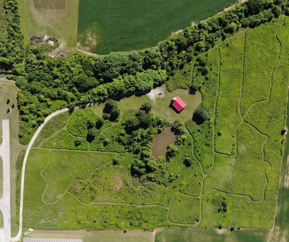
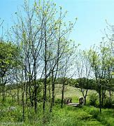
Woody Species Removal at Larry R. Yoder (OSU Marion) Campus Prairie 10:00 am - 3:00 pm 1465 Mount Vernon Avenue, Marion Marion County The Ohio State Marion Campus Prairie is a 12-acre tallgrass restoration located in central Marion County. Located on former farmland in a region that once included prairie and savannah ecosystems, it was established in the mid-1970’s by Ohio State Marion students and faculty using seeds and plants from nearby Sandusky Plains remnants. Containing a diverse array of grasses and forbs, the area is used as a living laboratory by college classes and, being open to the |
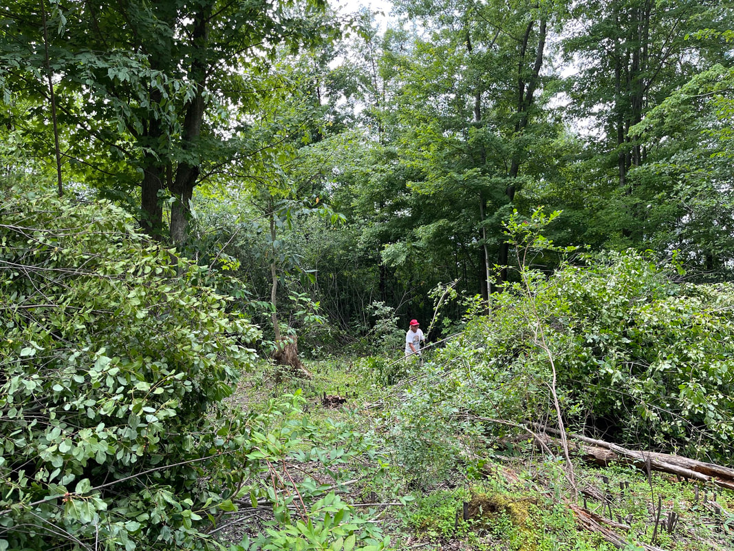
public, it is frequently visited by nature-loving community members. In recent years, shrubs have begun to take over the grassland portions of the site. Amur honeysuckle dominates the understory of sparsely wooded sections adjacent to a small pond in the center of the tract. Restoration efforts this winter will focus on removing these honeysuckle shrubs to facilitate replacing them in spring with desirable native nursery-grown specimens.
Directions: The prairie is located behind the campus of OSU Marion on State Route 95, or Mount Vernon Avenue, easily accessed from US Route 23. Take State Route 95 west from US Route 23 and turn left into the campus. The prairie can be found behind the campus (see map).
What to bring: Bring lunch, water, gloves, and good hiking boots. Herbicide treatment will be done by licensed or trained ONAPA stewardship assistants and volunteers. Tools will be provided.
RSVP: If you would like to attend, please REGISTER. If you have questions, please contact The Ohio Natural Areas and Preserves Association HERE. Online registration is important for our planning.
|
Thursday, January 18, 2024
Woody Species Removal at North Bend Bog (Cleveland Museum of Natural History) 10:30 am - 3:30 pm North Bend Road, 41°51'15.8"N 80°52'45.8"W Ashtabula County ONAPA will be joining the Cleveland Museum of Natural History and The Nature Conservancy in a joint effort to remove glossy buckthorn from the Museum's North Bend Bog. North Bend Bog is a part of the Museum's Geneva Swamp preserve. This 1,600+ wetland complex is the largest tract of typical Lake Erie Lake Plain Swamp |
Forest within the Lake Erie Plain from Cuyahoga County to the Pennsylvania line. Its wetland communities, such as Elm-Ash-Maple Swamp Forest, Buttonbush-Sphagnum Ponds, and Beech-Yellow Birch Hummock Hollow Forest, as well as the scattered dry forests on sand ridges and knolls, protect the complex of wetlands that formerly occurred in present day downtown Cleveland.
Directions: The preserve is on North Bend Road, west off S.R. 45. Map directions are found at: https://maps.app.goo.gl/Xt9Y4HF7TtHqKX7g6?g_st=i
What to bring: Bring lunch, water, gloves, and good hiking boots. Herbicide treatment will be done by licensed or trained ONAPA stewardship assistants and volunteers. Tools will be provided.
RSVP: If you would like to attend, please REGISTER. If you have questions, please contact The Ohio Natural Areas and Preserves Association HERE. Online registration is important for our planning.
|
RESCHEDULED TO Thursday, January 25, 2024
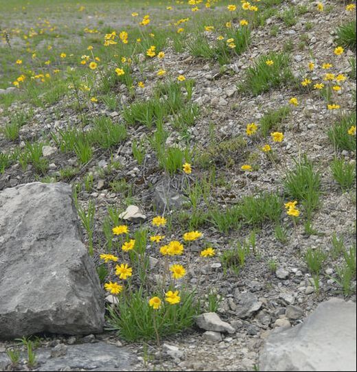
Woody Species Removal at Castalia Quarry Metro Park 10:30 am – 3:30 pm 8404 State Route 101, Castalia Erie County Castalia Quarry Metro Park is a former limestone quarry site protected by Erie County Metro Parks. Its rugged 152 acres includes woods and barren limestone, modified alvar areas. The quarry was abandoned in 1965, but the quarry pit is still barren with minimal vegetation. Lakeside daisy was introduced to a few of the limestone alvar areas in 2012 and has been doing well. We will be removing woody species in one of these areas to improve habitat for the Lakeside daisy and other rare plants. |
Directions: Castalia Quarry is located on State Route 101, just east of the town of Castalia. We will meet at the parking lot on the north side of the road and hike in to the Lakeside daisy site.
What to bring: Bring lunch, water, gloves, and good hiking boots. Herbicide treatment will be done by licensed or trained ONAPA stewardship assistants and volunteers. Tools will be provided.
RSVP: If you would like to attend, please REGISTER. If you have questions, please contact The Ohio Natural Areas and Preserves Association HERE. Online registration is important for our planning.
|
Thursday, February 1, 2024
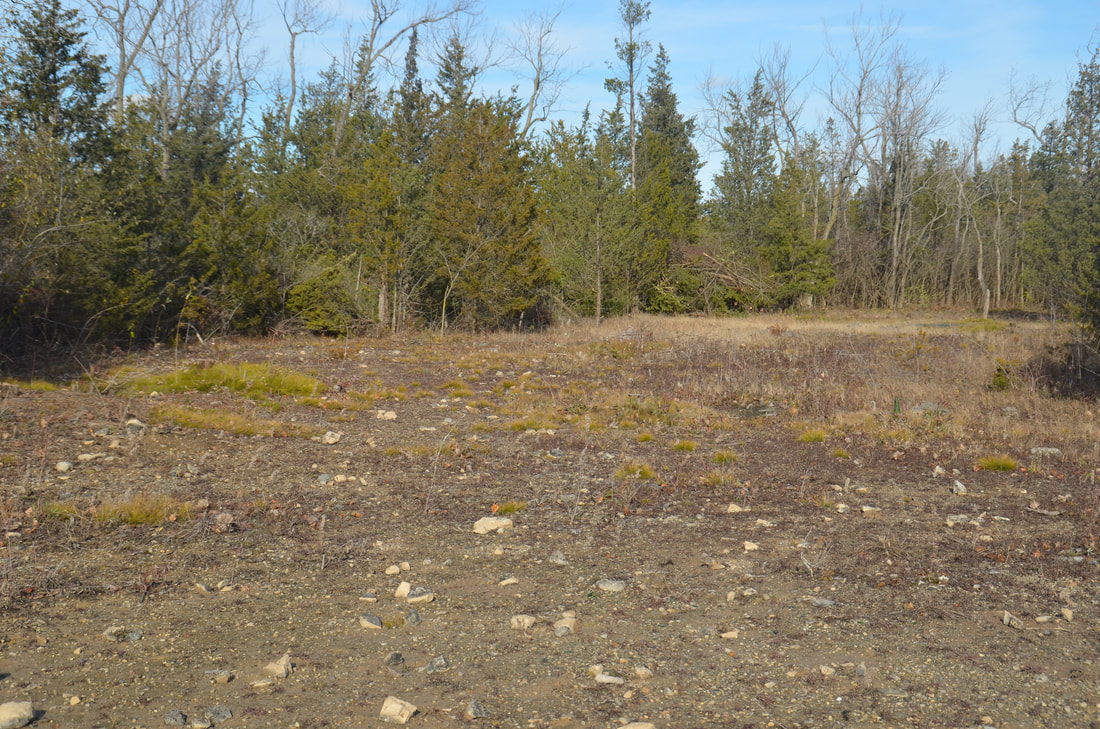
Woody Species Removal at Lakeside Daisy State Nature Preserve 10:30 am – 3:30 pm Alexander Rd, Marblehead Ottawa County Lakeside Daisy State Nature Preserve is home to Lakeside daisy and at least 11 other state-listed rare plant species. Lakeside daisy is listed as Threatened by the US Fish & Wildlife Service (1988) and Endangered by the Division of Natural Areas & Preserves (1980). It is only known to occur naturally in Ohio on the Marblehead Peninsula and two locations in Ontario. It has been reintroduced to Illinois and one small population of questionable origin occurs in the Upper Peninsula of Michigan. DNAP and USFWS have introduced the daisy to Kelleys Island and Castalia Quarry Metro Park in appropriate limestone habitat. The Lakeside Daisy SNP was first acquired at 19 acres of abandoned quarry land in 1988, but fortunately DNAP was able to purchase another 118 acres from Lafarge-Holcim for daisy protection and restoration. Our project involves removal of woody species, primarily red cedars, to improve habitat for the daisies and other listed plants on the original north section. We will be cutting and |
treating woody species, hauling the trees and shrubs to brush piles
Directions: We will meet at the Lakeside Daisy SNP on Alexander Pike where the preserve sign is located (north end). What to bring: Lunch, water, hiking boots. DNAP, USFWS, and ONAPA will provide tools and conduct the herbicide application. RSVP: If you would like to attend, please REGISTER. If you have questions, please contact The Ohio Natural Areas and Preserves Association HERE. Online registration is important for our planning. |
Tuesday, February 6, 2024 (Bonnet Pond Bog NOT frozen)
Woody species removal at Jackson Bog State Nature Preserve
Woody species removal at Jackson Bog State Nature Preserve
10:30 am – 3:30 pm
7984 Fulton Drive NW, Massillon
Stark County
Jackson Bog is a 58-acre preserve located in northern Stark County and owned by the Jackson Township Local Board of Education and the Ohio Division of Natural Areas and Preserves. The area was dedicated in 1980 as an interpretive preserve. It is actually a fen, or alkaline wetland, which lies at the foot of a dry, sandy kame (a glacially deposited hill or ridge). The belts of kames in this area of Stark County provide an extensive aquifer. These highly permeable gravel deposits readily absorb surface water and then hold it in staggering quantities as groundwater. The alkalinity is a limiting factor which dictates the types of unique plants which grow there. While the preserve is surrounded by residential development, a large school system, and a township park, it contains an amazing amount of plant and animal diversity, particularly many rare plant species. Habitat management is critical in the fen meadows to maintain the biodiversity of this small preserve.
We will be cutting and treating invasive plant species such as glossy buckthorn which is encroaching in the fen meadows. We will be cutting and treating woody stems with herbicide, and removing the cut stems from the fen meadows.
Directions: Located in Stark County, 2 miles north of Massillon on Fulton Drive and a 1/2 mile west of the intersection of State Route 687 and State Route 241. The preserve is adjacent to Jackson Township Park.
What to bring: Bring lunch, water, gloves, and muck boots. Herbicide treatment will be done by DNAP staff or trained ONAPA volunteers. Tools will be provided.
RSVP: If you would like to attend, please REGISTER. If you have questions, please contact The Ohio Natural Areas and Preserves Association HERE. Online registration is important for our planning.
Thursday, February 8, 2024
Woody Species Control at Killbuck Marsh Wildlife Area
Woody Species Control at Killbuck Marsh Wildlife Area
|
10:00 am – 3:00 pm
S.R. 83 PFO site (Holmes County) This 5,671-acre wildlife area is situated in northeastern Ohio in portions of Wayne and Holmes counties. The area extends north from Holmesville to three miles south of Wooster, and lies between State Route 83 on the east and State Route 226 on the west. The area is in a shallow, U-shaped glacial outwash valley. Approximately half of the wildlife area consists of marsh and swamp that is flooded during some portion of the year. This |
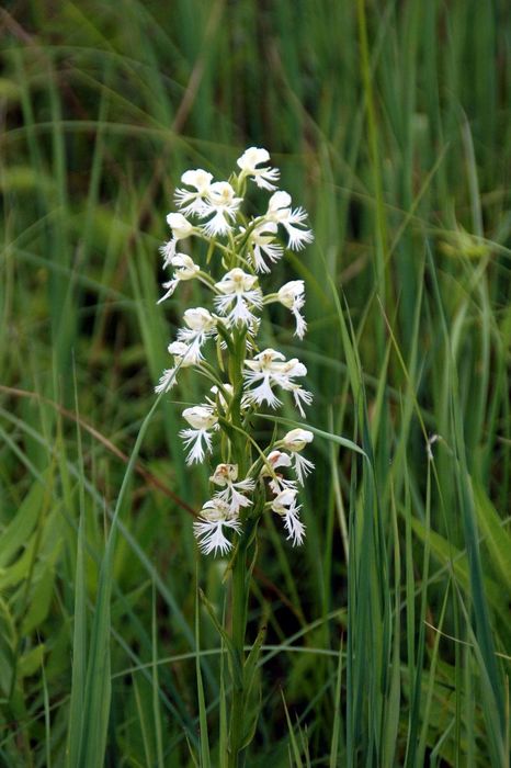
wetland complex is Ohio’s largest remaining marshland outside of the Lake Erie region. We will be working at one of the sites for Eastern prairie fringed orchid (PFO) which occurs at Killbuck Marsh.
We will be cutting woody species, primarily dogwood, alder, and willow, hauling brush out of the sedge meadow, and treating the cut stems with herbicide. Herbicide treatment will be done by DOW staff or trained ONAPA volunteers. ONAPA will provide loppers and handsaws.
Directions: This PFO site is located on the west side of S.R. 83, north of Holmesville. We will park off the road near the oil well tanks. If you have not worked at this site before, more detailed directions will be sent to you after you register for the project.
What to bring: Bring lunch, water, gloves, and good hiking boots. Herbicide treatment will be done by licensed or trained ONAPA stewardship assistants and volunteers. Tools will be provided.
RSVP: If you would like to attend, please REGISTER. If you have questions, please contact The Ohio Natural Areas and Preserves Association HERE. Online registration is important for our planning.
|
Thursday, February 15, 2024
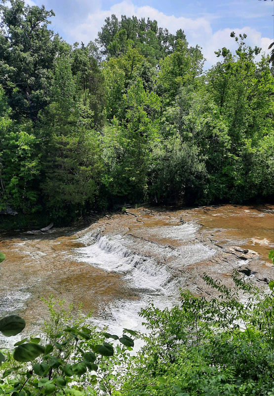
Woody Species Removal at Greenville Falls (Miami Co. Park District) 10:30 am – 3:30 pm 4720 Rangeline Road (Miami County) Greenville Falls was designated as a state scenic river area, located on Greenville Creek, by the Division of Natural Areas & Preserves. Within the protected 92 acres, there is a system of trails which takes visitors along the creek, through prairie openings, and past many historical remnants from an old electric mill. The views of Greenville Falls are impressive, as are the limestone cliffs. We will be removing woody species in the prairie openings above the creek to improve habitat for the prairie species. This site is managed by the Miami County Park District; the project will be done in cooperation with Park District staff. Directions: We will be meeting at the parking lot on Rangeline Road on the east side of Greenville Creek. It is an easy walk from this parking lot to the prairie openings that we will be working in. |
What to bring: Bring lunch, water, gloves, and good hiking boots. Herbicide treatment will be done by licensed or trained ONAPA stewardship assistants and volunteers. Tools will be provided.
RSVP: If you would like to attend, please REGISTER. If you have questions, please contact The Ohio Natural Areas and Preserves Association HERE. Online registration is important for our planning.
RSVP: If you would like to attend, please REGISTER. If you have questions, please contact The Ohio Natural Areas and Preserves Association HERE. Online registration is important for our planning.
best example in north central Ohio of what famous Ohio ecologist, Paul Sears called “oak openings.” The 114-acre preserve owned by the private non-profit organization, Killbuck Watershed Land Trust, protects two oak barrens containing 6 state-listed plants, including the threatened thyme-leaved pinweed. ONAPA has been assisting the KWLT with habitat management to restore the two oak openings. We will be working in the South Barrens, cutting and treating woody stems. Trained KWLT and ONAPA volunteers will conduct the herbicide application.
Directions: From Brinkhaven (Gann) on U.S. Rt. 62, drive about 4 ¼ miles east on U.S. Route 62 to Holmes Co. Rd. 25. Drive about ¾ mile north to an intersection and turn left (west) on to Township Road 13. Drive for about
1.2 miles and the parking lot will be on the right. The parking lot is about 500 feet beyond the old railroad overpass, on the right (it is hard to see as it is a grass parking lot with no signage).
What to bring: Bring lunch, water, hiking boots, gloves. ONAPA and KWLT will provide tools and conduct herbicide application.
RSVP: If you would like to attend, please REGISTER. If you have questions, please contact The Ohio Natural Areas and Preserves Association HERE. Online registration is important for our planning.
The state-endangered Yellow-bellied Sapsucker, a small woodpecker, utilizes wooded habitat in the park for foraging and shelter. Granite boulders carried by Ohio’s last ice age 100,000 years ago dot the landscape. Small streams that comprise the headwaters of Wolf Run, which flows to the Kokosing River, grace the landscape.
We will be assisting the Knox County Park District to control woody species invading grassland units which have been burned recently (ONAPA helps the park district with prescribed burning). We will work in at least two units in or adjacent to Wolf Run Park, which is located on the east side of Mount Vernon.
DIRECTIONS: We will meet at the park district house on Yauger Road, which is just east from the Wolf Run main parking lot.
What to bring: Bring lunch, water, gloves, and good hiking boots. Herbicide treatment will be done by licensed or trained ONAPA stewardship assistants and volunteers. Tools will be provided.
RSVP: If you would like to attend, please REGISTER. If you have questions, please contact The Ohio Natural Areas and Preserves Association HERE. Online registration is important for our planning.
NEW DATE: Thursday, March 7, 2024
Hemlock Wooly Adelgid Survey at Lake Katharine SNP
Hemlock Wooly Adelgid Survey at Lake Katharine SNP
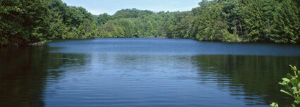
and over 6 miles of hiking trails, surrounded by spring wildflowers and many rare plants, including the bigleaf magnolia. Hemlock wooly adelgid (HWA) was found in the preserve in 2013 and today we will be assisting preserve manager, Josh Deemer conduct additional surveys for HWA to document the extent of the 20+-acre infestation. HWA is a small, destructive, non-native insect from Asia which sucks sap from hemlocks. Winter months are the best time to conduct these surveys; we will be closely inspecting low-hanging hemlock branches to look for evidence of HWA, most noticeable as white wooly masses on the underside of the branches. Be prepared for extensive, rugged hiking.
Directions: Meet at the main parking lot near the maintenance building. The parking lot can be reached by taking State Street west out of Jackson about 2 miles, then turning right on County Road 85 (Lake Katharine Road) and proceeding 2 miles to the main parking lot.
What to bring: Lunch, water, hiking boots, trekking poles, hand lens (if you have one), gloves.
RSVP: If you would like to attend or have questions, please contact The Ohio Natural Areas and Preserves Association HERE.
|
NEW DATE: Tuesday, March 12, 2024
Woody Species Control at Cedar Bog State Nature Preserve 10:30 am – 3:30 pm 980 Woodburn Road, Urbana Champaign County Cedar Bog has been referred to as "The Crown Jewel of Natural Areas in Ohio." While there are many crown jewel nature preserves in Ohio, this special preserve is located in southern Champaign County in the Mad River Valley between the Farmersville and Springfield moraines. The moraines were left behind when the Wisconsin Glaciers receded 10,000-15,000 years ago. Cedar Bog is actually a fen (not a bog), with a constant source of alkaline water flowing through it. Cedar Bog has the highest biodiversity index of any preserve in the state and is home to many rare, threatened and endangered animal species.
|
ONAPA volunteers will be helping DNAP and the Cedar Bog Association remove white cedars and other invasive species in fen meadows. The stems will be cut and treated with herbicide in most locations and the woody stems removed from the meadows.
Directions: Cedar Bog is located off of US 68 at 980 Woodburn Road, about 3 miles south of Urbana and 1 mile north of the Clark/Champaign County line.
What to bring: Bring lunch, water, gloves, and good hiking boots. Herbicide treatment will be done by licensed or trained ONAPA stewardship assistants and volunteers. Tools will be provided.
RSVP: If you would like to attend, please REGISTER. If you have questions, please contact The Ohio Natural Areas and Preserves Association HERE. Online registration is important for our planning.
Tuesday, March 19, 2024
Woody species control at Medway Prairie Fringed Orchid Site
Woody species control at Medway Prairie Fringed Orchid Site
|
10:00 am – 3:00 pm
Union Road, Medway Clark County This site is a small wetland, primarily an alkaline wet sedge meadow surrounded by farm fields, and is owned by the City of Dayton’s Water Department as a wellfield. The U.S. Fish & Wildlife Service and DNAP have been cooperating with the City of Dayton by verbal agreement since a significant population of the Eastern prairie fringed orchid was reported at this site in 1993. Regular habitat management is necessary to maintain the open sedge meadow, which has been declining for several years due to woody species encroachment. ONAPA will be cooperating with USFWS and DNAP on this project to cut and treat woody species in the area where most of the orchids are located. Directions: From Columbus, proceed west on I-70. Take exit 26B to exit onto Spangler Road north towards Medway. After crossing the Mad River, turn right on to Union Road. The site, owned by the City of Dayton, Water Department, is on the right. Parking will be along the roadside. |
What to bring: Bring lunch, water, gloves, and good hiking boots. Herbicide treatment will be done by licensed or trained ONAPA stewardship assistants and volunteers. Tools will be provided.
RSVP: If you would like to attend, please REGISTER. If you have questions, please contact The Ohio Natural Areas and Preserves Association HERE. Online registration is important for our planning.
RSVP: If you would like to attend, please REGISTER. If you have questions, please contact The Ohio Natural Areas and Preserves Association HERE. Online registration is important for our planning.
|
Thursday, March 28,2024
Woody Species Control at Travertine Fen 10:30 am - 3:30 pm SR 725, Spring Valley Greene County Travertine Fen contains a high-quality prairie fen with numerous rare species. The preserve is owned and managed by Greene County Parks and Trails. An access permit from Greene County Parks and Trails is required to visit the preserve. This 21-acre site is located northeast of the Little Miami Scenic Bikeway, just beyond the Bellbrook Avenue Bridge. It is a protected wetland fed by springs and is home to many rare species. This state nature preserve has had little management in the fen meadows for many years. |
ONAPA has offered to work with DNAP to restore the fen meadows which are overrun with woody species and cattails. On this stewardship project, we will be working in one of the fen meadows to cut and treat woody species, pushing back the woody species around the fen meadow core.
Directions: We will be parking along SR 725, near the bike trail and auto body shop. We will walk back along the bike trail to access the preserve and fen meadows.
What to bring: Bring lunch, water, gloves, and good hiking boots. Herbicide treatment will be done by licensed or trained ONAPA stewardship assistants and volunteers. Tools will be provided.
RSVP: If you would like to attend, please REGISTER. If you have questions, please contact The Ohio Natural Areas and Preserves Association HERE. Online registration is important for our planning.
