MEMBER 2016 FIELD TRIPS & EVENTS
DRAGONFLIES AND DAMSELFLIES OF THE DARBY PLAIN
|
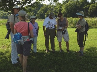
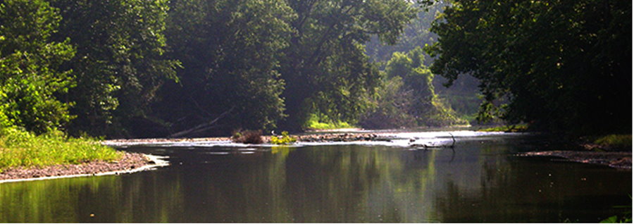
The dragonfly and damselfly expedition on a pleasant and breezy Saturday, July 26, 2014, was a resounding success. About two dozen people were present for the event. The trip leaders were Dr. Jim Davidson, Guy Denny, and Cheryl Harner. Everyone was mesmerized by the color, beauty, and diversity of these fascinating, flying insects. We immersed ourselves in the habitats in which they live. Wading in Big Darby Creek to get up-close views of the energetic odonates was a highlight of the day. Some of the dragons and damsels even posed long enough to have their portraits taken.
|
Not a current ONAPA member? You can join or renew now using PayPal or
by downloading a membership form HERE.
Mosses and Lichens for Beginners
Saturday, April 2 at 10 a.m.
Little Rocky Hollow State Nature Preserve
Hocking County
Register for this member trip HERE
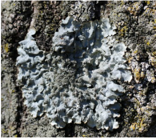
Barb Andreas & Ray Showman will lead this walk in search of mosses and lichens. Many ONAPA members are interested in these organisms but we rarely have the opportunity to go out into the field with experts in these groups and now is our chance. Little Rocky Hollow, a permit only preserve, is a wonderful example of a hardwood-hemlock ravine system. Spectacular rock formations of Mississippian age Black Hand sandstone tower over the stream valley supporting an enormous collection of ferns, lichens, mosses and liverworts.
Directions: Meet in the Little Rocky Hollow parking lot, which is off Kreashbaum Road. From Conkle's Hollow (near the intersection of St. Rt. 374 and County Road 11), take Big Pine Road (Co. Rd. 11) northeast to Kreashbaum Road. Turn left onto Kreashbaum Road and continue for 1.2 miles to the parking lot on the left.
Fen Wildflower Walk
Saturday, April 30 at 10 a.m.
Prairie Road Fen & Gallagher Fen State Nature Preserves
Clark County
Register for this member trip HERE
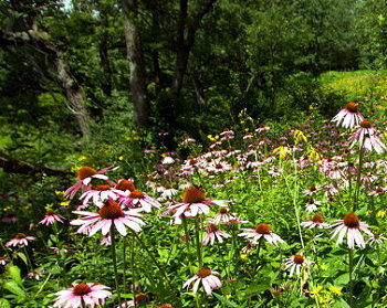
Dan Boone will lead this hike, which is a joint field trip between Ohio Natural Areas and Preserves Association (ONAPA) and the Cincinnati Wild Flower Preservation Society. These are high-quality fens, some of the best examples of prairie fen communities in the state. We’ll also see a gravel hill prairie. Many state-listed species are found in these preserves. We are expecting to see the rare northern bog violet and native sweetgrass. Pack a lunch.
Directions: We will start at Gallagher Fen. From Cincinnati, head north on I-75 toward Dayton. Take Exit 43 to get on I-675 North. Drive about 25 miles and take exit 26A to merge onto I-70 East and head toward Springfield. Take I-70 East for 15 miles to Exit 62 for US 40. Turn right onto US 40 and travel 0.2 miles. Turn left onto Bowman Road. Drive for 1.2 miles and turn left onto Old Columbus Road. Drive for almost 2 miles to the parking lot on the left.
Blackhand Gorge State Nature Preserve Historical Walk
May 7, 2016
10 a.m,
Newark, OH
Licking County
Register for this member trip HERE
Dick Moseley, ONAPA secretary and retired Chief of DNAP, and Bill Weaver, founder of the nonprofit Friends of Blackhand Gorge, will lead this educational field trip. Standing in the parking lot at Blackhand Gorge State Nature Preserve, you are on the original site of the village of Toboso. The community was moved to higher ground during the construction of Dillon Dam. The 957-acre preserve was dedicated as an Interpretive Preserve on September 20, 1975. The natural area has a variety of habitats including a buttonbush swamp, upland forests of oak, hickory, Virginia pine, and mountain laurel, and riverine forests and floodplain. Yellow birch, sweet birch, and eastern hemlock are found in the moist environs of the gorge. It is an excellent site for viewing woodland spring wildflowers. Historically, this is the location where the Black Hand Sandstone was first named and described. Blackhand Gorge is not only a significant natural history site, but also an important human history site. The Licking River and Blackhand Gorge Tunnel have represented every form of transportation in its history with the exception of aircraft: walking, canoes, canal boats, railroads, electric trolleys, horse and wagons, automobiles and now bicycles. The gorge has seen it all and now you can enjoy its history and natural beauty on this field trip when you visit the locks, the “Deep Cut,” where you will be able to view the site of the Black Hand petroglyph on the sandstone outcrop across the river, the electric trolley tunnel and more.
Directions: Blackhand Gorge State Nature Preserve is located eight miles east of Newark and is reached from Newark via S. R. 16 east to S.R. 146 south, and then right on Toboso Road (C. R. 273) to the preserve parking lot. Note there are multiple entrances, be sure to use these directions.
Wetland Tour at Kitty Todd State Nature Preserve
May 14, 2016 at 10 a.m.
10420 Old State Line Road.
Swanton, Ohio
Lucas County
Register for this member trip HERE.
Leader: Ray Stewart
Kitty Todd Preserve is one of the finest nature preserves in the Oak Openings region of northwestern Ohio. The preserve was named in honor of Toledo conservationist and former Nature Conservancy board member, Kitty Todd.
The Oak Openings region was originally characterized by a series of windblown sand dunes and wetlands that were saturated in winter and spring and extremely dry in summer. These conditions gave rise to vegetation ranging from dry sand barren and oak savanna on the raised dunes to moist sedge meadow and wet prairie in the low-lying swales. Kitty Todd supports a number of these small sand dunes, interesting examples of the unusual geology of the Oak Openings region.
Directions: For driving directions click HERE. Located in western Lucas County north of Old State Line Road. From Interstate 475 on the west side of Toledo:
- Exit at Airport Highway (State Route 2), traveling west toward the Toledo Express Airport
- Turn right (north) on Eber Road
- Eber Road dead ends into Old State Line Road
- Turn left onto Old State Line Road
- Follow the signs to the preserve office and parking lot at 10420 Old State Line Road.
Daughmer Prairie Savannah State Nature Preserve Tour
Saturday, May 28, 2016 at 10 a.m.
786 Marion-Melmore Road
Bucyrus, Ohio
Crawford County
Register for this member trip HERE
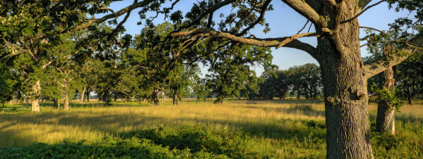
Daughmer Prairie Savannah is managed by the Crawford County Park District. The field trip leader will be Warren Uxley, naturalist with Crawford County Parks. Warren, who is an excellent birder and botanist, will focus on the rare sedges and prairie species growing here. This is an outstanding 34 acre prairie savanna situated in the once extensive Sandusky Plains of Crawford County. This site has never been plowed and in addition to native tallgrass prairie, the savanna supports huge bur oak trees 150-300 years old.
Directions: Daughmer is located about 8 miles southwest of Bucyrus, Ohio. Participants should meet in the nature preserve parking lot located at 786 Marion-Melmore Road, Bucyrus, Ohio.
Heritage Garden Tour at the Governor’s Residence

Tuesday, May 31, 2016 at 10 a.m.
358 N. Parkview Ave.
Bexley, Ohio 43209
Franklin County
Register for this member trip no later than May 23rd HERE.
This will entail a tour of the Ohio Heritage Garden at the Governor’s Residence in Bexley, Ohio lead by former First Lady, Hope Taft and ONAPA President Guy Denny. The tour will last about one hour or more depending upon our also taking a tour on the inside of the residence.
Participants must pre-register by no later than Monday May 23rd so their names can be placed on the visitor’s list for admittance as required by the Ohio State Highway Patrol. For security purposes, participants must also show a photo identification such as a driver’s license for entry on to the grounds; no exceptions.
The Heritage Garden established under the direction of former Ohio First Lady, Hope Taft, showcases the various plant community types represented in each of the five major physiographic regions of Ohio.
Directions: From I-670, exit onto 5th Avenue (exit 7) and turn east (right). Turn south (right) onto Cassady Avenue (3rd light). Turn west (right) onto Maryland Avenue (1st light). The Residence is on the corner of Maryland and Parkview. Park on Maryland Avenue or adjoining streets.
Prairie Walk at Smith's Cemetery, Bigelow Cemetery, and Milford Center Prairie State Nature Preserves
Saturday, July 16, 2016 at 10 a.m.
Madison County, Ohio
Join Dave Kuehner and Michelle Comer, DNAP Preserve Manager, who will lead this joint field trip with the Cincinnati Wild Flower Preservation Society. There are very few remnants of the prairie vegetation that was historically common on the Darby Plains in west central Ohio. Bigelow Cemetery and Smith Cemetery date from the early 1800s and today are outstanding examples of a prairie cemetery. Both sites have rich and diverse populations of prairie grasses and wildflowers. The stunning population of purple coneflower at Smith may be the finest in the state. One of the few Ohio populations of the striking royal catchfly is at Bigelow. Milford Center Prairie is a railroad prairie that contains the largest and most diverse assemblage of prairie plants in the Darby Plains.
Note: Be sure to pack a lunch. We’ll begin at Bigelow and go to Smith before lunch. We’ll eat lunch and head to Milford Center.
Directions: Meet at Bigelow. Take I-70 west out of Columbus to exit 80 for Ohio 29. Take Ohio 29 west for 4.5 miles to Ohio 38. Turn right (north) onto Ohio 38 and travel for 0.5 mile to just south of Plumwood, where you will turn left on Rosedale-Milford Center Road. Travel for 6 miles and turn right onto Rosedale Road. Travel for 3 miles to Bigelow Cemetery SNP, which is on the west side of the road.
To continue to Smith Cemetery SNP, head north on Rosedale Road and turn right on Ohio 161. Head east on Ohio 161 for 4 miles. Turn right onto Unionville Road, which becomes Boyd North Road. Turn left on Boyd Road and drive for 1 mile to Smith Cemetery SNP, which will be on the north side of the road.
Milford Center Prairie SNP is located off of Ohio 4 southwest of Milford Center.
Alvar & Glacial Grooves Walk
Tuesday, July 19, 2016
Field Trip to Lafarge Quarry Lands
Marblehead, OH
You must be preregistered and space is limited.
Register for this member trip HERE.
Trip specifics and meeting location will be emailed to registered participants.
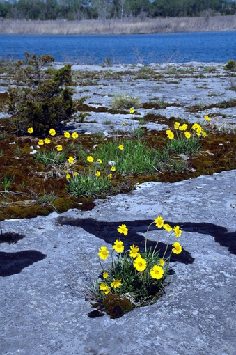
On May 17, 1890, when botanist Clarence M. Weed collected the first known specimen of Lakeside Daisy (Tetraneuris herbacea) from the Marblehead Peninsula near the community of Marblehead, Ohio, he listed the collecting site as “Limestone plains of the Sandusky Peninsula near Lakeside.” Here, the Columbus Limestone lies close to or at the surface making the peninsula very attractive for the mining limestone. Numerous small, privately owned quarry operations sprung up in the late 1800s, but at the time Clarence Weed botanized the area, the Marblehead Peninsula was largely an undisturbed, intact, botanically rich cedar glade that supported a fascinating array of rare prairie and alvar plants including the Lakeside Daisy. Since that time, the Standard Slag Company purchased the privately owned quarries and accelerated quarrying operations. Later they sold their operations to Lafarge Aggregates Company who now operate the site as the largest quarry operation in Ohio. Today almost all of the Marblehead Peninsula as been either developed or quarried destroying virtually all of the original natural landscape.
Only one small area in the original quarry lands remains virtually as it existed back in the 1800s, and this is the site we will be visiting. In addition to high quality prairie and alvar species, this site has glacial grooves and very large areas of exposed bedrock with extensive glacial striations; possible the best in the Nation. Since this is private property belonging to Lafarge and not open to the public, field trip participants will be required to pre-register for this field trip and sign a liability release agreement. Participants will be required to pre-register by no later than Tuesday, July 12th. Additional information will be provided after you register.
ONAPA Summer Picnic - Food, Friends & Fun

July 30, 2016
10 a.m. - 2 p.m.
6021 Mt. Gilead Road
Fredericktown, OH
Knox County
Please let us know you will be joining us: sign up HERE.
Plan on attending a great field trip and cook-out at Guy Denny’s prairie in Knox County. His 22 acres of planted prairie are about 20 miles east of the original prairies of the Sandusky Plains. This is one of the best created prairies in Ohio and is designed to look as the prairies in that area would have looked prior to European settlement.
Our host, Guy Denny, is a gifted naturalist and storyteller who brings to life the history of the prairie with stories of the plants and the people who lived with the grasslands. Learn about the origin, ecology and numerous prairie plants native to the state. Come with your questions and appetite. ONAPA experts will discuss anything on prairies or any other question you may have about our great state’s nature preserve system. The field trips on this site will begin at 10 am and run until 1 pm. The picnic from 11:30 am to 2 p.m. will be hosted by ONAPA for our members and friends. Your presence will provide the camaraderie and friendship for an all-around good time throughout the event. That’s why it’s called Food, Friends & Fun.
Directions: From Interstate 71, take the 151 exit at State Route 95 and go east on SR95 just less than 5 miles to 6021 which is the first driveway on the north side of SR95 just inside the Knox County line. Easy walking but it can get hot this time of year.
Brinkhaven Oak Barrens Nature Preserve Walk

Saturday, August 13, 2016
10 a.m.
Holmes County
Leaders: Rick Gardner, Ohio State Botanist, and Jennifer Windus, ONAPA Vice President
Register for this member trip HERE.
Brinkhaven Oak Barrens Nature Preserve was designated as a state natural landmark in 2005 for being the best example in north central Ohio of what famous Ohio ecologist Paul Sears called “oak openings.” The 114-acre preserve owned by the private non-profit organization, Killbuck Watershed Land Trust, protects two oak barrens containing 6 state listed plants including the threatened thyme-leaved pinweed. We will discuss the ecology of the site, how it was protected, its state-wide significance, current management, and identify the many fascinating animals and plants that occur at this special site.
Directions: From Brinkhaven (Gann) on U.S. Rt. 62, drive about 4 ¼ miles east on U.S. 62 to Holmes Co. Rt. 25. Drive about ¾ mile north to a 4-way stop. Turn left (west) on to Township Route 13. Drive for about 1.2 miles and the parking lot will be on the right. The parking lot is about 500 feet beyond the old railroad overpass.
Prairie Seed Collecting
Saturday September 24, 2016
10 a.m.
6021 Mt. Gilead Road
Fredericktown, OH
Knox County
Leader: Guy Denny
Register for this member trip HERE.
If you have ever wanted to grow your own little patch of Ohio prairie, here is your chance to collect Ohio native prairie seeds and give it a try. During this tour, we will discuss methods and techniques for creating and managing your own patch of prairie and participants will be given the chance to collect small amounts of prairie seeds in paper bags that will be provided.
Directions: From Interstate 71, take the 151 exit at State Route 95 and go east on SR95 just less than 5 miles to 6021 which is the first driveway on the north side of SR95 just inside the Knox County line. Easy walking but it can get hot this time of year.
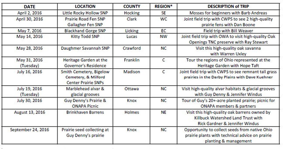
FIELD TRIP SUMMARY
|
*Regions of Ohio:
NW = northwest NE = northeast C = central SW = southwest SE = southeast WC = west-central NC = north-central |
